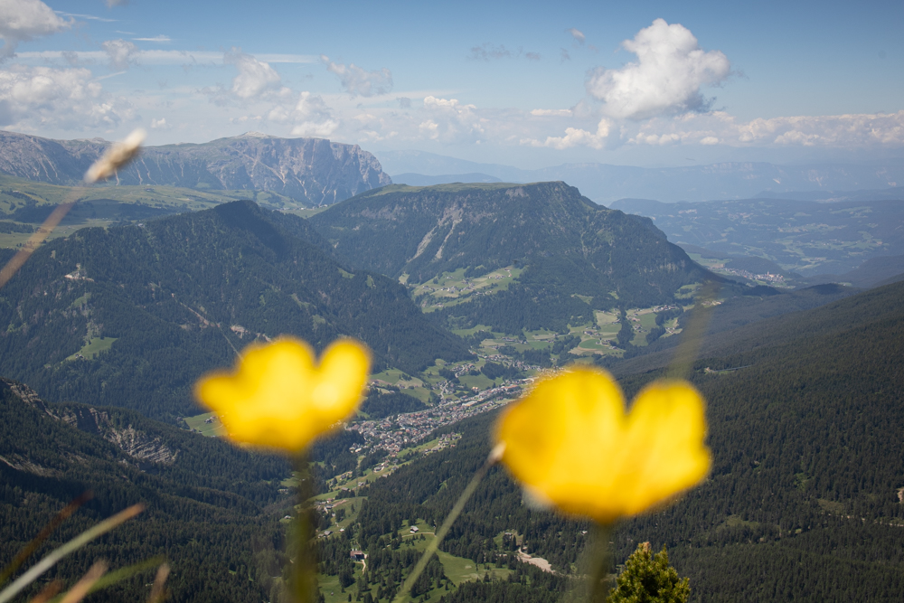
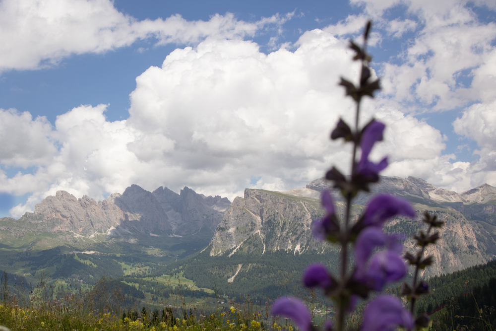
Ah, the Dolomites… an etherial place to truly let the senses indulge, with its rolling hills and charming mountain huts nestled in fields of luscious grass and wildflowers, contrasted by towering, rocky peaks. The mesmerizing natural beauty of this mountain range is part of the reason it was declared a UNESCO World Heritage Site in 2009.
If you’re planning to visit the Dolomites and wondering whether it’s possible or worthwhile without a car, the answer is yes!
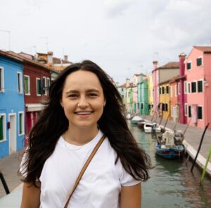
Huzai and I spent 9 magical days in the summer based in Ortisei in Val Gardena, exploring the natural wonders of the Dolomites all without a car.
I’m sharing this itinerary based on our incredible experience.
The itinerary will allow you to enjoy some of the most impressive sights in the Dolomites, including Resciesa, Seceda, Alpe di Siusi, Sassolungo and Vallunga, all of which are easily accessible from Val Gardena without a car.
Complimentary to this itinerary, make sure to check out my ultimate guide to visiting the Dolomites without a car, which has all the info on how to get to the Dolomites, the best places to stay without a car, how to get around, where to eat, and more!
About this itinerary
There are a few things to keep in mind as you read through this itinerary and start planning your trip:
- This itinerary is designed for visiting in the summer, and requires you to take some lifts that are only open during the warmer months. The lift that opens the latest and closes the earliest that is required for this itinerary is the chairlift from Santa Cristina to Monte Pana, open from June 18 to September 18. If you are visiting outside of these dates, this lift as well as some others may be closed and buses may be running on modified schedules. Double check the Val Gardena website to make sure the lifts you need to take are running if you are planning to visit during the shoulder season.
- The program as outlined requires you to move at a healthy pace but is also balanced and allows time for some rest and relaxation. I wouldn’t recommend trying to condense it, but you can always extend it out over additional days and add activities as you’d like. There are plenty more hikes and activities you can do without a car in the Dolomites – for some ideas, check out the Bonus activities section below for some things that are on my radar for my next trip!
General tips
- Transportation: Purchasing a Gardena Card allows you to use all local lift facilities in the summer. As part of this itinerary, you will be required to take various lifts across Val Gardena to get to the trailheads on 4 out of the 5 days. The card is available in two versions: either for six consecutive days (115.0 Euros) or for three consecutive days (85.00 Euros). For this itinerary, getting the 3 day pass and paying for the round trip ticket to take the Resceisa Furnicular (required for the day 4 hike) will cost 5 Euros less than getting the 6 day pass. However, if you think you might do additional hikes requiring you to take a lift, the 6 day pass could be a good idea.
- Weather: The weather is cooler in the mountains and can change quickly, so even when visiting in the summer, make sure to have a long sleeve layer option and a light jacket. Be prepared for rain as well.
- Activities: The Val Gardena Active association organizes different activities including cooking classes, tasting tours, hikes, bike rides, wildlife spotting tours, etc, that you may want to incorporate into your itinerary. Check out their summer programming or ask your accommodation for more details.
Day 1: Hiking Resciesa to Seceda
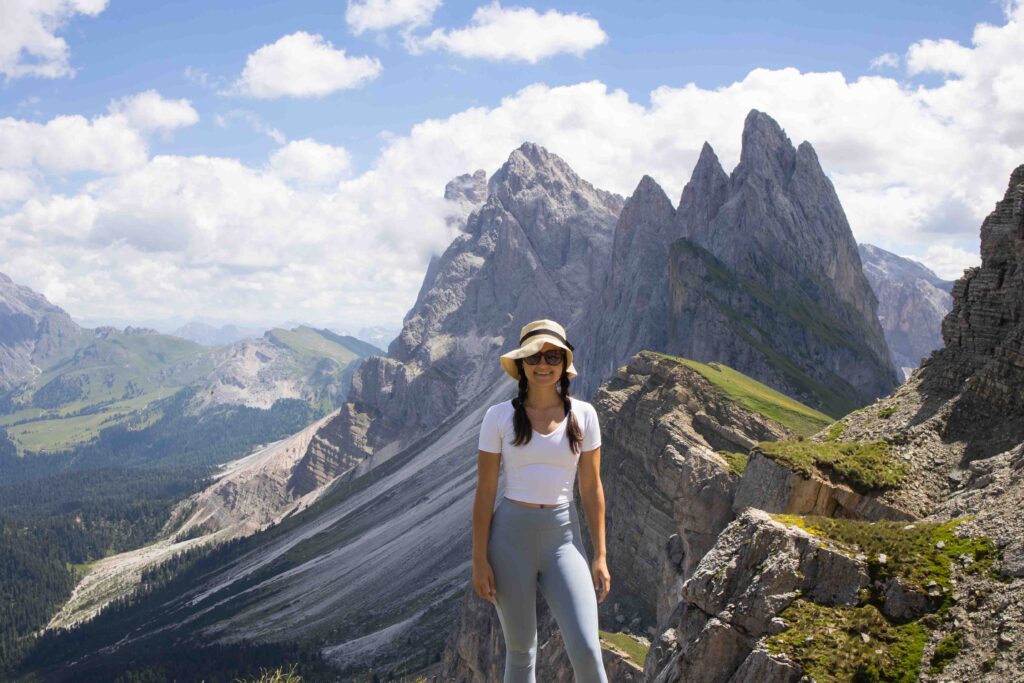
On your first full day in the Dolomites, you will have gotten a glimpse of the wonder that awaits, and you’ll be pretty pumped to start exploring (I certainly was!). The plan is to do a relatively challenging hike, channelling all your excitement into a 14 km trek with an ascent of just over 1000 metres from Resciesa to Seceda, two of the most striking sights in the Dolomites.
- Starting point: Ortisei
- Length: 13.8 km
- Walking time: 5.5 hours
- Itinerary: Ortisei > Resciesa mountain station > Brogles Hut > Mesdi/Mittagsscharte > Malga Pieralongia > Seceda/ Mastlé Hut > Ortisei
- Difficulty level: Difficult
- Elevation Gain: 1049 meters
- Elevation Loss: 699 meters
- Lift to ascend: Resciesa cable railway (open May 14 – September 10)
- Lift to descend: Furnes – Seceda cable car (open May 28 – February 11), Ortisei – Furnes gondola (open May 28 – February 11)
Resciesa mountain station to Brogles Hut
Take the cable railway from Ortisei up to the mountain station of the Resciesa Hut. From there, take Trail 35, which will bring you to the mostly flat “Innerraschötzer” Hut. After about 1.5 hours, you’ll reach Brogles Hut. The food at this hut is good, but the views are the real treat.
This is a great point to stop for lunch take in the views.
Mesdi/Mittagsscharte to Seceda
Continue following Trail 35 for 30 minutes, until you reach Trail 29. Turn right onto Trail 29 and climb up to the famous wind gap, Furcela De Mesdi/Mittagsscharte, where you will enjoy incredible views of the surrounding mountainscape. After descending, follow signs to Pieralongia and Seceda. After passing the Pieralongia alpine pasture, continue to the Seceda Ridgeline.
Once you get to the Seceda, take the cable car down to Furnes, and gondola down to Ortisei, or walk the additional 2.5 hours if you’re up for it.
Note: There used to be an option to cross over the Odle / Geisler Group via the Forcella di Pana / Panascharte, but this route is currently closed due to a rockfall.
Day 2: Paragliding over the Dolomites and exploring Alpe di Siusi
The second day brings more amazing views while giving the legs a bit of a break :), with tandem paragliding in the morning and a light hike around the meadows of Alpe di Siusi in the afternoon.
Paragliding over the Dolomites
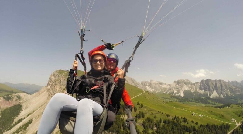
Depending on your level of fitness, there is a good chance you will be tired from the previous day’s hike (I was quite sore the following day). So, on day 2, let the wind carry you. 🙂 Paragliding over Val Gardena is a truly magical experience. I felt like a bird flying high over the mountains and valleys with views into the horizon in all directions.
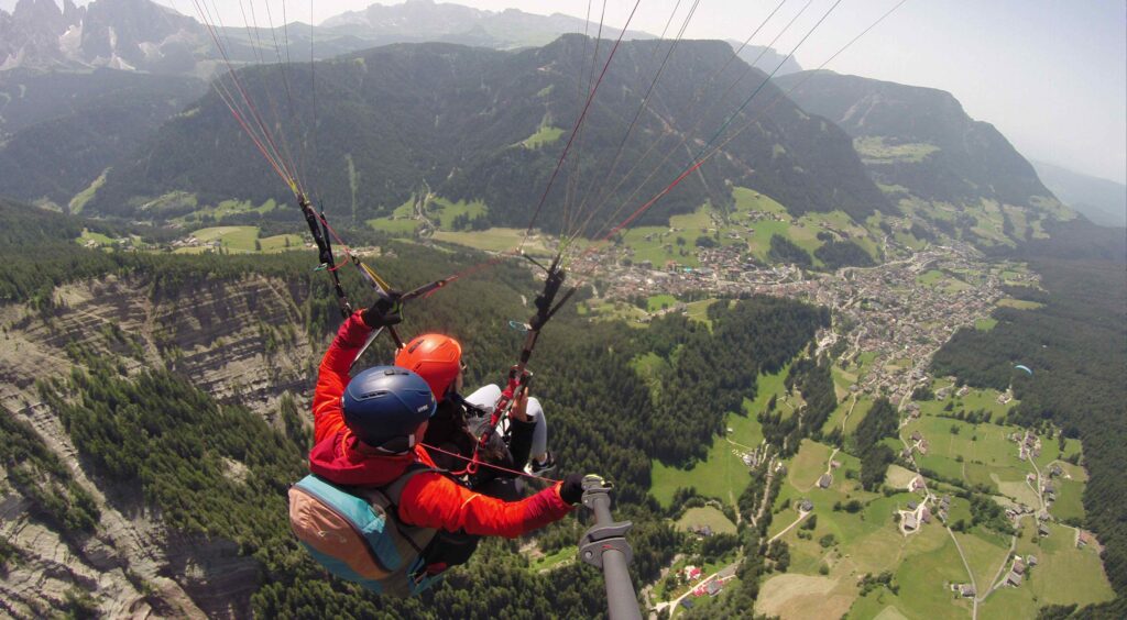
There are two companies in Ortisei that offer tandem paragliding experiences. Huzai and I went with fly2 and had a great experience.
The company you book with will tell you where and when to meet them and you will likely need to purchase a lift pass to climb up to the takeoff point. We met at the Seceda lift and went up with our pilots.
We did the Gliding Flight from Seceda which was 20 – 25 minutes long and cost 170€. Before the flight, I was nervous about whether I’d be able to run fast enough for takeoff. However, it turns out that Olympic sprinter speed is not required and it was all good. 🙂 The rest of the flight was actually very serene for me, with only the sound of the wind in my ears and views of the Italian alps that seem to go on forever in all directions.
The entire experience takes about 1 hour and 15 minutes.
The Gliding Flight from Seceda lands right beside a really nice hut not far from the Seceda lift, where we grabbed a delicious lunch with our pilots. We had a steak and a burger, and the portions were massive!
After this we, went back to the lockers at the Seceda lift, grabbed our things and said goodbye.
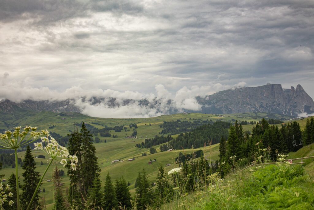
Leisurely tour of Alpe di Siusi
In the afternoon, you’ll do a walk around Alpe di Siusi, and enjoy the charming views of the Seiser Alm meadow, the largest high alpine meadow in Europe. The Seiser Alm has countless trails that are all well-marked. So, if you want to do a shorter or longer trail, there are plenty of options. In fact, if you want to simply wander around the rolling meadows, you can do that too!
The walk I’ve outlined below allows you to enjoy the picturesque views without being too strenuous and still allowing you to recover from the day before!
- Starting point: Ortisei
- Length: 5.3 km
- Walking time: 1.5 hours
- Itinerary: Ortisei > Funicular Alpe di Siusi (Mountain station) > >Contrin Hut > Sanon Hut > Schgaguler Hut > Funicular Alpe di Siusi (Mountain station) > Ortisei
- Difficulty level: Easy
- Elevation gain: 208 m
- Elevation loss: 208 m
- Lift to ascend: Ortisei – Alpe di Siusi gondola (open May 14 – Feb 11)
- Lift to descend: Same as above
To get to the starting point of the hike, take the Seiser Alm lift from Ortisei town centre, up to the Seiser Alm mountain station.
When you exit the lift, take Path 6A, walking past the Contrin Hut. Once you get to the crossroad, stay on Path 6 and then take a left onto Path 6B. You will soon reach the Sanon Hut followed by the Sonne Chairlift.
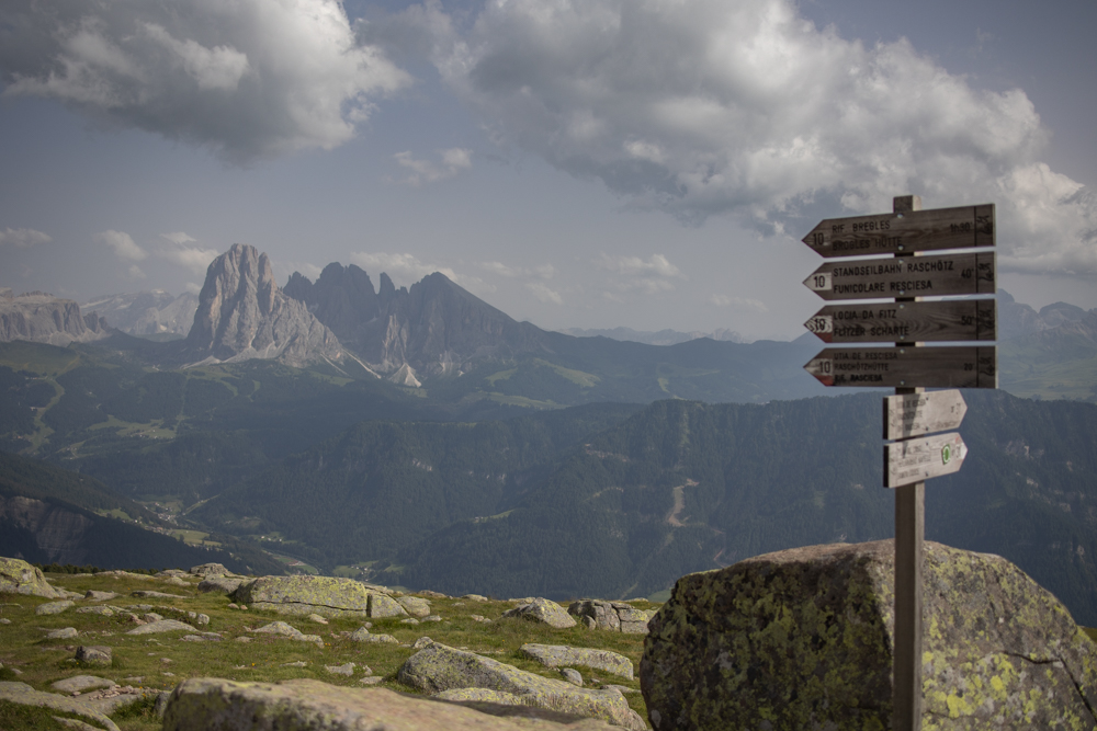
From here, take Trail 9 which leads to Schgaguler Hut and then back to the Seiser Alm mountain station. The circuit offers a breathtaking views of the Sassolungo Group, the Sella massif and the Sciliar.
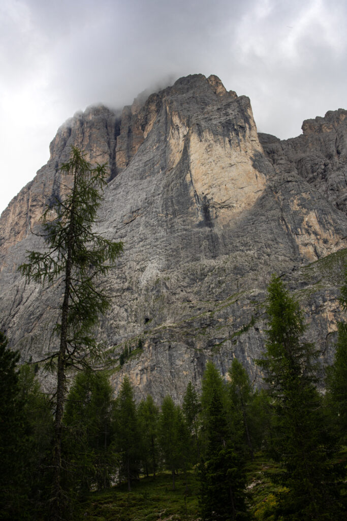
Day 3: Hiking around the base of the Sassolungo Group
At this point, you will be a bit more rested and ready to take on the next challenge – the Sassolungo Group Loop, a 17 km loop around Sassolungo, climbing and descending about 800 m.
- Starting point: Santa Cristina
- Length: 17.3 km
- Walking time: 5.5 hours
- Itinerary: Santa Cristina > Mont de Sëura > Forcella Sassolungo > Passo Sella > Rifugio Sasso Piatto > Mont de Sëura > Monte Pana > Santa Cristina
- Difficulty: Medium
- Elevation gain: 815 m
- Elevation loss: 815 m
- Lift to ascend: S. Cristina – Monte Pana Chairlift 2 (open Jun 18 – Sept 18), Mont de Sëura Chairlift 4 (open Mar 6 – Oct 10)
- Lift to descend: Same as above
Santa Cristina to Mont de Sëura to Passo Sella
Take the bus from San Antonio Square in Ortisei to Santa Cristina. The bus ride is about 10 minutes.
From the bus stop in Santa Cristina, it’s less than a five minute walk to the Monte Pana chairlift. Take this lift up to Monte Pana, and then take the Mont de Sëura chairlift. The Mont de Sëura lift will take you to the top of Mont de Sëura, which is the base of the Sassolungo group. Take a left when you get off the lift, in the direction of the Comici Hut (526B + 528 + 526). In about 1 hour and 45 minutes you will reach Passo Sella.
Friedrich August path to Rifugio Sasso Piatto / Plattkofel Hut, and back to the starting point
From Passo Sella, follow the Friedrich August path (557) up to Rifugio Sasso Piatto / Plattkofel Hut, which takes about 3.5 hours to reach from the starting point of the hike. This is a great place to stop for lunch.
From the hut, continue left on Path 527, taking in the stunning views of the Seiser Alm. Take Path 527 to 526 and finally to 526B, which will take you back to the starting point on Mont de Sëura.
Take the lift down and walk to the Santa Cristina bus stop to head back to Ortisei.
Day 4: Easy loop around the Resciesa summit
The hike I’ve outlined for day 4 is relatively short and easy with plenty of amazing views along the entire circuit. It should take you about 2 hours, with the rest of the day left open to spend as you please.
- Starting point: Ortisei
- Length: 5 km
- Itinerary: Ortisei > Funicular Resciesa Mountain Station > Außerraschötz > Funicular Resciesa Mountain Station > Ortisei
- Walking time: 2 hours
- Difficulty level: Easy
- Elevation gain: 185 m
- Elevation loss: 185 m
- Lift to ascend: S. Cristina – Monte Pana Chairlift 2 (open Jun 18 – Sept 18), Mont de Sëura Chairlift 4 (open Mar 6 – Oct 10)
- Lift to ascend: Resciesa cable railway (open May 14 – Sept 10)
- Lift to descend: Same as above
Take the Furnicular from Ortisei up to the Funicular Resciesa Mountain Station.
Walk north-east from the mountain station and you will reach Costa dl Cason. Take Trail 31 from the intersection to proceed towards Außerraschötz. Along this path, you can enjoy the unique views of the Puez-Geisler Nature Park. Follow Path 1 followed by Path 10 until you reach the summit cross. Here you’ll once again get some stunning views of the Dolomites.
Descend to the Heilig-Kreuz Chapel. From there, Path 35 will take you back to the starting point. You can take the Furnicular down or return to Ortisei by foot (which would take about 1.5 hours).
Day 5: Exploring the Vallunga and spa afternoon
For the last day, you will take it easy, exploring the mostly flat Vallunga park and spending the afternoon at the spa.
How to get to Vallunga from Ortisei
Catch the 350 bus from Piazza S. Antonio in Ortisei (see the SudtirolMobil bus timetables here) and get off at Wolkenstein, Nivesplatz. Walk about 30 minutes (directions here) to the entrance of Vallunga.
Walking through the Vallunga
At the beginning of the hike, the path splits into 2, both leading to the St. Sylvester’s Chapel. The path on the left has a moderate incline and takes you through the forest, while the path on the right leads directly to the chapel.
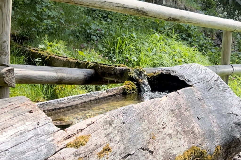
At the chapel, check out the centuries-old frescoes that were discovered during the last restoration of the building, and fill your water bottle with fresh mountain spring water at the fountain next to it.
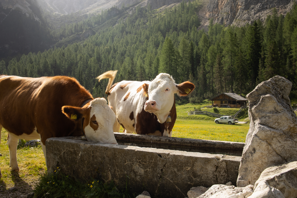
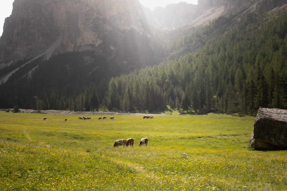
Continue along the path through the forest, past a field of boulders and eventually to the Prà da Ri, a huge mountain meadow where cows graze in ultimate tranquility. It’s a great spot to have take a break, have a snack, or even a picnic.